Walking Tours in Auckland
30 Landmarks in Auckland
Albert Park
Princes Street, Auckland CBD
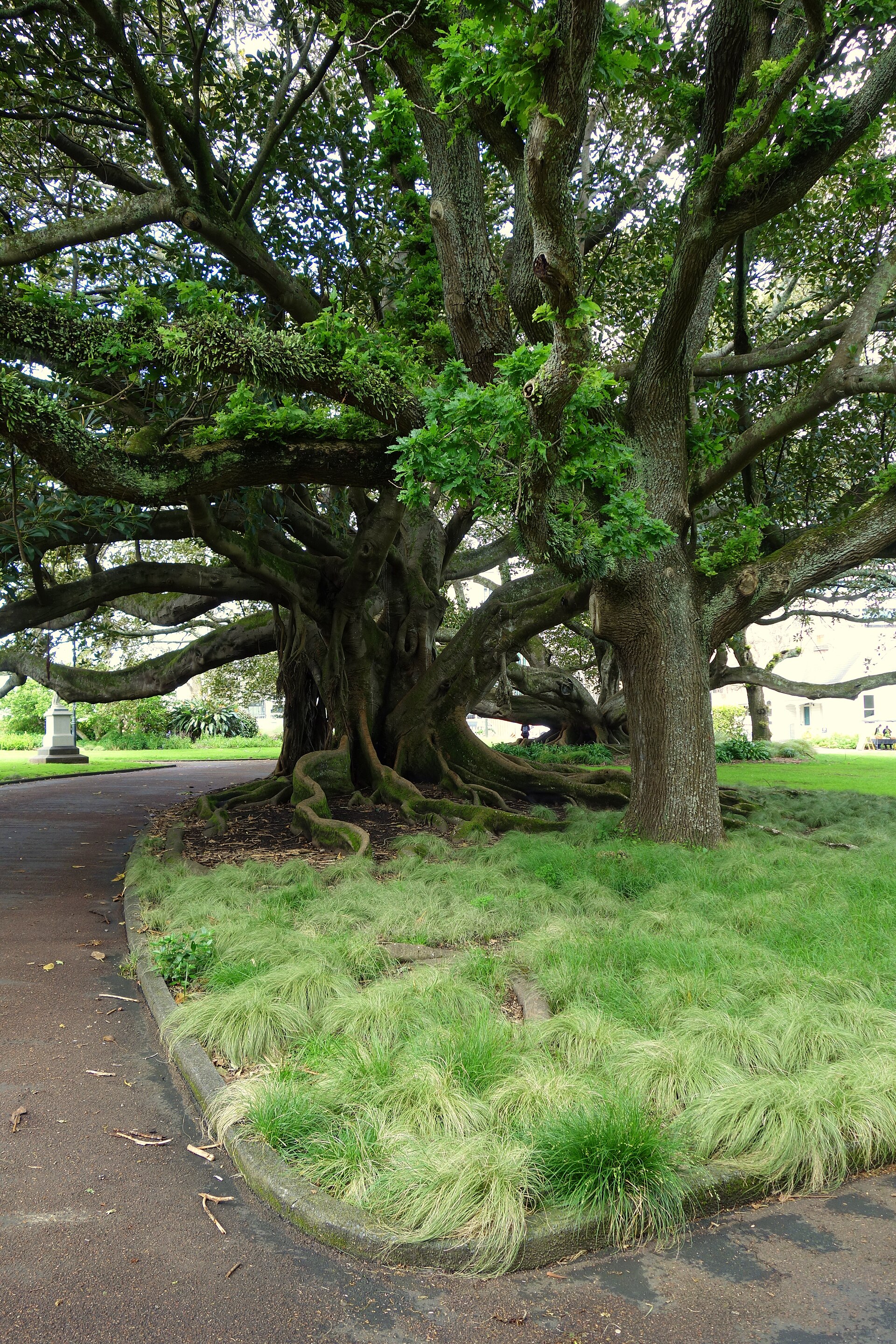
Albert Park is downtown Auckland's historic central park — 5.3 hectares of Victorian garden at the top of Auckland University, with formal bedding, palm trees, a fountain, a marble statue of Queen Victoria (erected 1899), and the old gun emplacements from the 19th-century Albert Barracks preserved around the edges. The park opened to the public in 1882 on the site of a former British military barracks; the barracks wall survives along Alfred Street. The park is the university's unofficial front lawn — lunchtime fills it with students, and the annual Auckland Lantern Festival (Chinese New Year) traditionally fills the park with thousands of silk lanterns and fills downtown with tens of thousands of visitors. The Band Rotunda at the park's centre dates to 1902 and is used for summer concerts. The park is bordered by Auckland Art Gallery, Auckland University's historic Clock Tower building, and the Old Government House, giving it a distinctive concentration of 19th-century civic architecture.
Auckland Art Gallery Toi o Tāmaki
Wellesley Street East, Auckland CBD
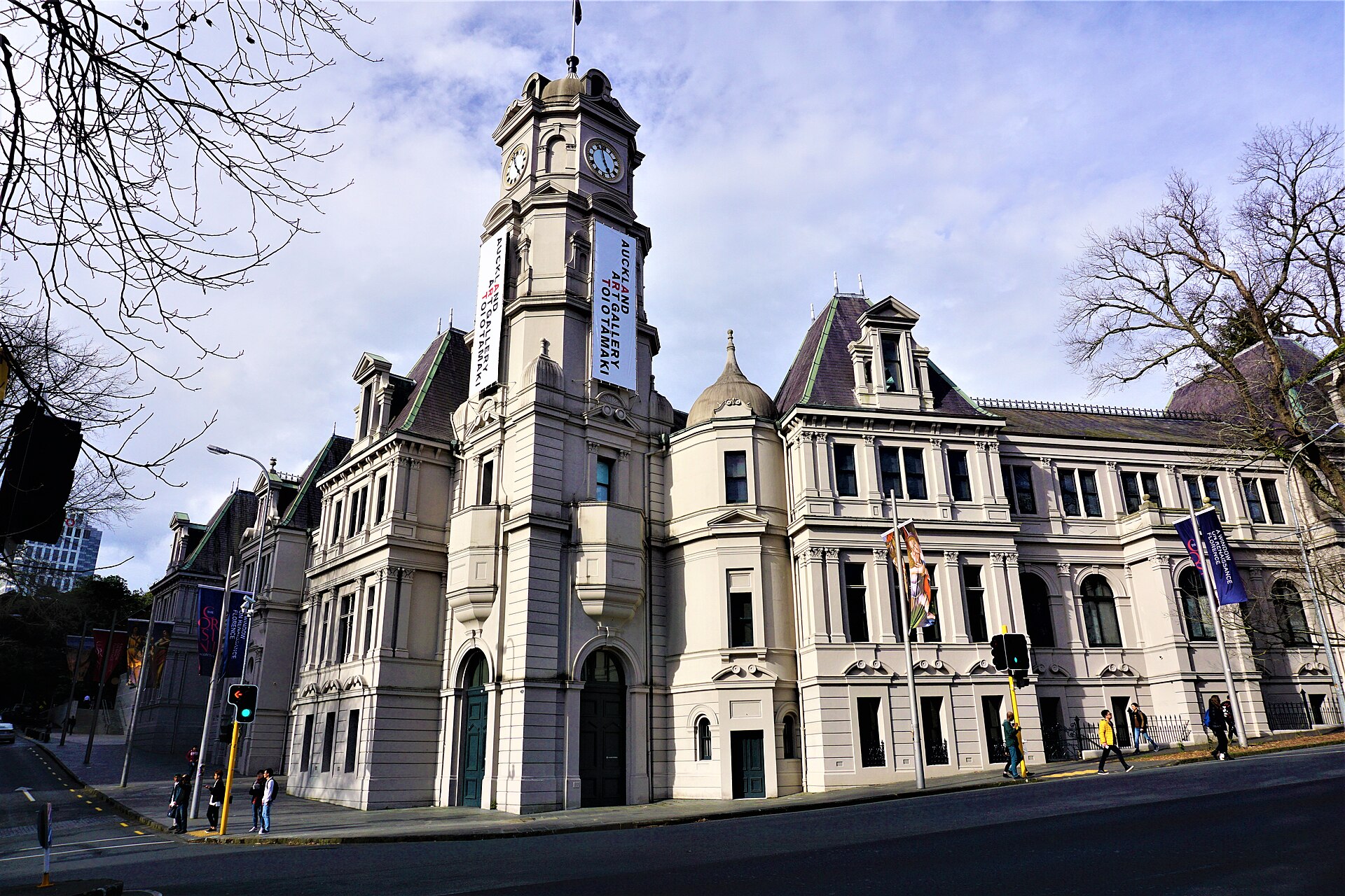
The Auckland Art Gallery (Toi o Tāmaki) is New Zealand's largest public art collection — housed in a dramatically remodelled 1888 French Renaissance building whose 2011 extension (designed by Francis-Jones Morehen Thorp) won the World Building of the Year award at the 2013 World Architecture Festival. The extension features a kauri wood ceiling with 20 tree-shaped ceiling pods that mimic the native forest canopy. The collection is strongest in New Zealand art — the Māori portrait series by 19th-century artist Gottfried Lindauer, the early 20th-century landscapes of Colin McCahon and Rita Angus, and the contemporary works of Shane Cotton, Michael Parekōwhai, and the many Pacific artists who have come to prominence since 2000. The international collection includes Goya, Gainsborough, and Picasso, and a Guan Yin bronze whose 12th-century date makes it one of the oldest artworks in New Zealand. Entry is free to the permanent collection.
Auckland Botanic Gardens
102 Hill Road, Manurewa
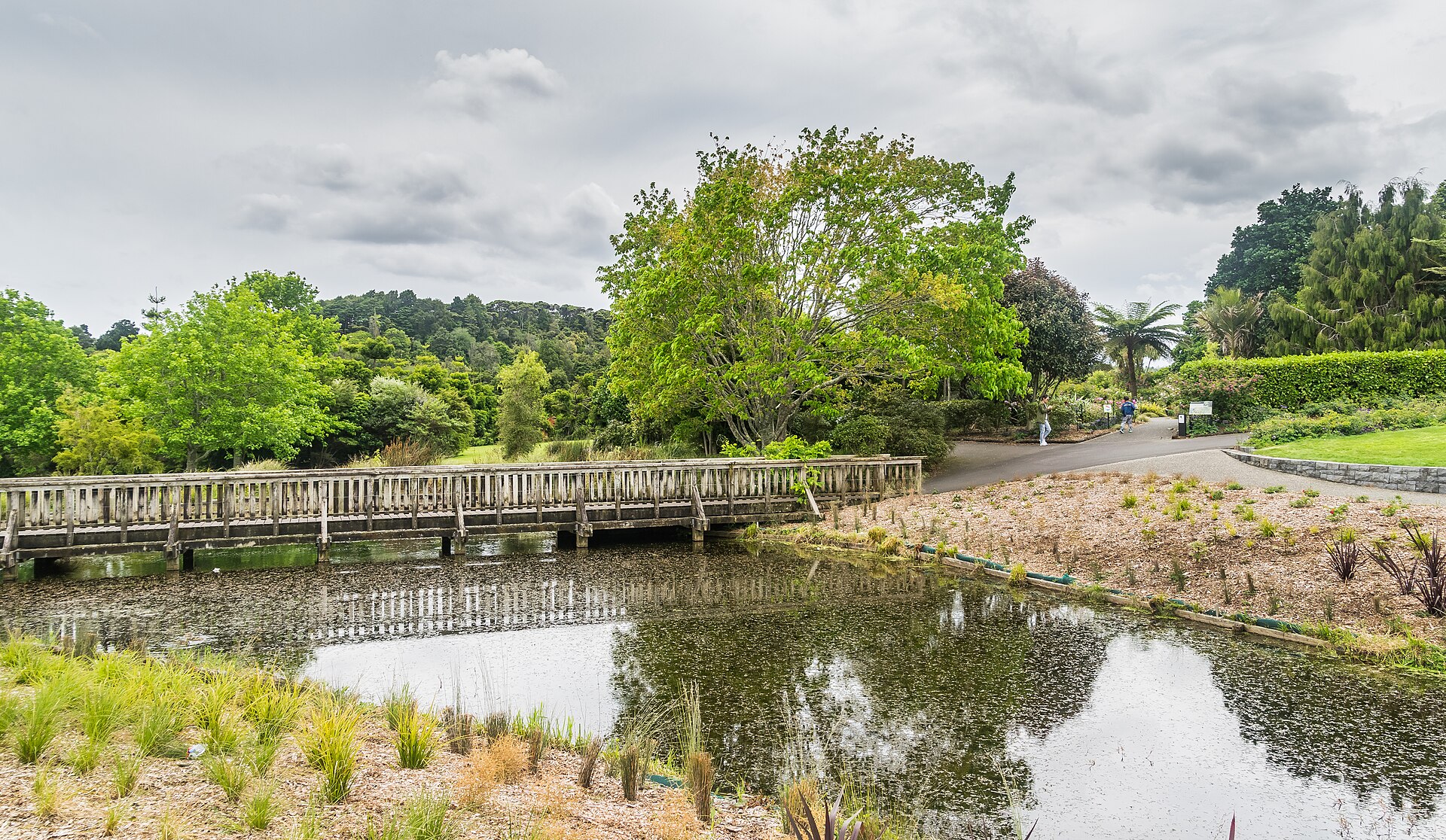
The Auckland Botanic Gardens are 64 hectares of themed gardens in Manurewa in south Auckland — the largest botanical collection in the city, opened in 1982 and home to over 10,000 plant species across 30 themed gardens including a Rose Garden, a Native Plant Ideas Garden (showcasing edible and useful New Zealand natives), a Potter Children's Garden with a giant kōura (freshwater crayfish) sculpture, and the Māori Plant Use Collection. Entry is free, and the layout is gentle enough for elderly visitors or families with strollers. The Edible Garden demonstrates urban food growing with an emphasis on sub-tropical species that thrive in Auckland's climate (citrus, avocado, tamarillo, feijoa), and the rhododendron gardens are spectacular in spring (September-October). The gardens are 30 kilometres south of central Auckland — car access is easier than public transport — and the adjacent Totara Park has walking trails and BBQ areas that make a half-day outing.
Auckland Domain
Parnell, Auckland
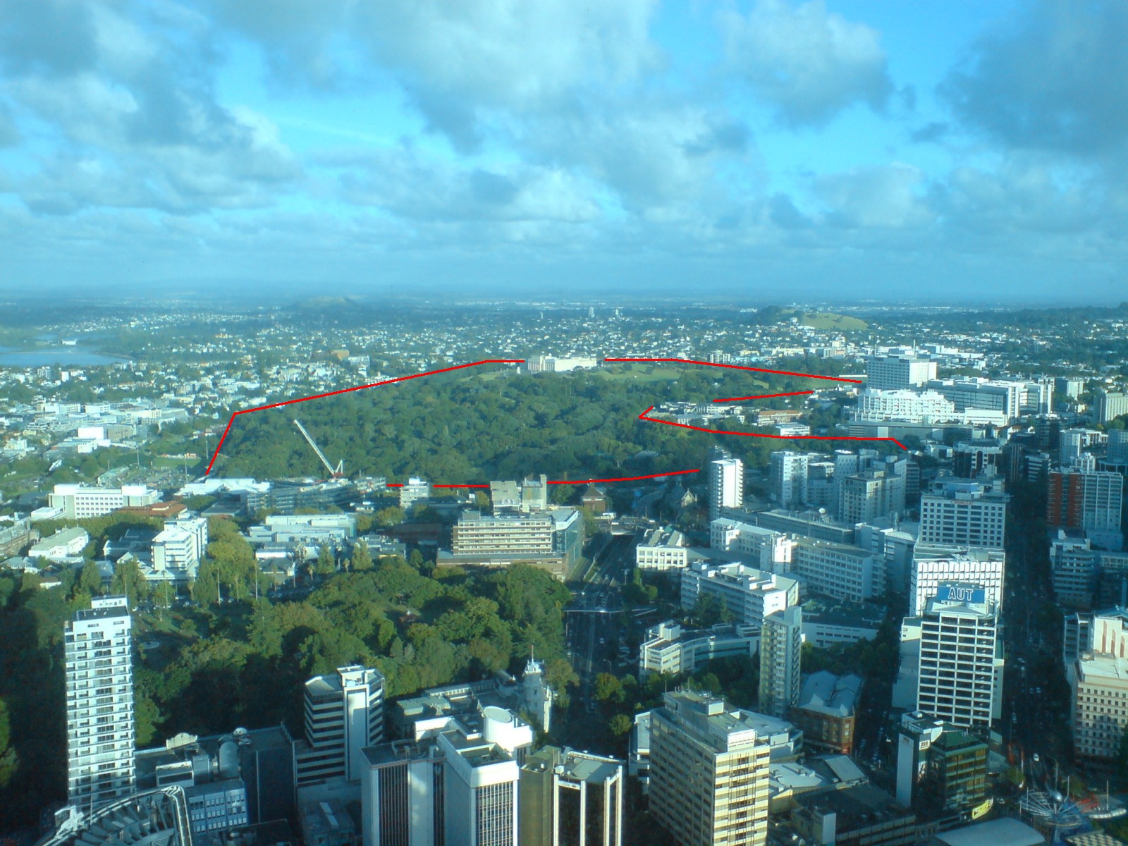
The Auckland Domain is the city's oldest and largest central park — 75 hectares of parkland, sports fields, winter gardens, and walking tracks laid out in the 19th century on the rim of the Pukekawa volcano cone and now the site of the War Memorial Museum. The park's topography (a classic volcanic crater) gives it a natural amphitheatre form, and the Auckland Domain Concert on Christmas Eve (a free orchestral concert drawing 50,000+ people) is one of the city's summer traditions. The Wintergardens (built in the 1910s and 1920s) are two glasshouses — one tropical, one cool-climate — connected by a fernery, and are the city's most photographed horticultural space. The Lovers' Walk and the Auckland Domain loop track provide quiet walking in the middle of the city, and the Parnell Rose Gardens at the northeastern corner feature 5,000 rose plants arranged in formal beds (best October through April). The Domain has been the location of the annual Diwali and Lantern festivals since 2003.
Auckland Fish Market
Jellicoe Street, Wynyard Quarter
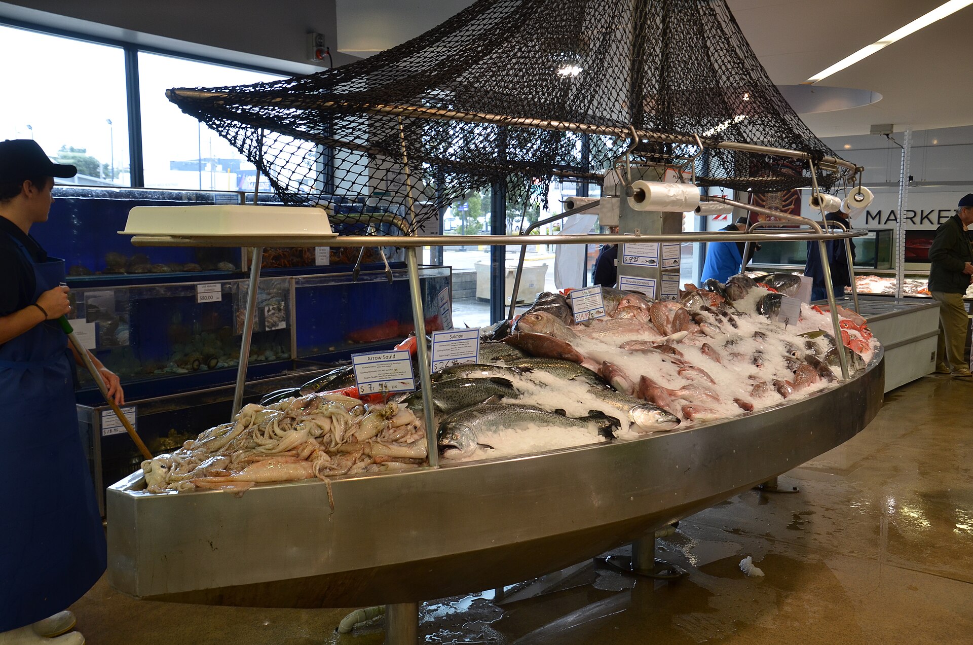
The Auckland Fish Market is New Zealand's main seafood hub — a wholesale-plus-retail market on Jellicoe Street in Wynyard Quarter that handles an estimated 3,000 tonnes of seafood a year and whose redeveloped food hall (opened 2019) has become a destination for oyster bars, fish-and-chip stalls, and sushi trains that showcase the country's wild seafood. The public market is open daily; the wholesale auction (from which local restaurants buy) starts at 5 AM weekdays and is worth watching if you are up early. The Saturday fresh-produce market that sets up alongside adds vegetables, cheese, and bread to the mix. The market connects to the rest of Wynyard Quarter — the Silo Park playground, the North Wharf restaurants, and Te Wānanga (the new public square completed for the 2021 America's Cup) — so a market visit is easily combined with a wider quarter walk.
Auckland Harbour Bridge Climb & Bungy
Westhaven Drive, Auckland
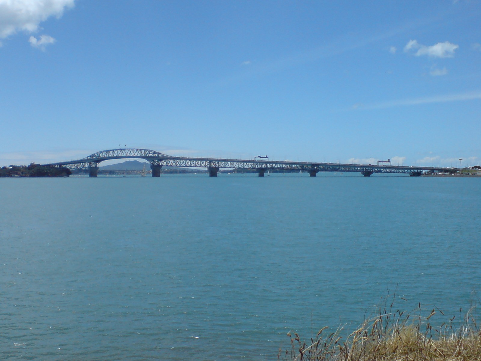
The Auckland Harbour Bridge is the city's defining infrastructure — a 1,020-metre cantilever truss bridge completed in 1959 that spans the Waitematā Harbour and that has been extended twice (1969 and 2000) to accommodate growing traffic. AJ Hackett Bungy operates two adventure experiences from the bridge: the Auckland Harbour Bridge Climb (a 1.5-hour guided walk along the upper superstructure) and the Auckland Harbour Bridge Bungy (a 40-metre fall from the outer arch that is the world's only bungy jump off a harbour bridge). The Climb provides a 360-degree panorama of the harbour from the highest point of the bridge, and guides provide commentary on the engineering, construction, and urban development the bridge enabled. The Bungy — brief, very expensive, and legitimately terrifying — is bookable on the same excursion. The departure point on Westhaven Drive is a 10-minute Uber ride from downtown, and the adjacent Westhaven Marina (Australasia's largest) is worth the short walk.
Auckland War Memorial Museum
Parnell, Auckland Domain
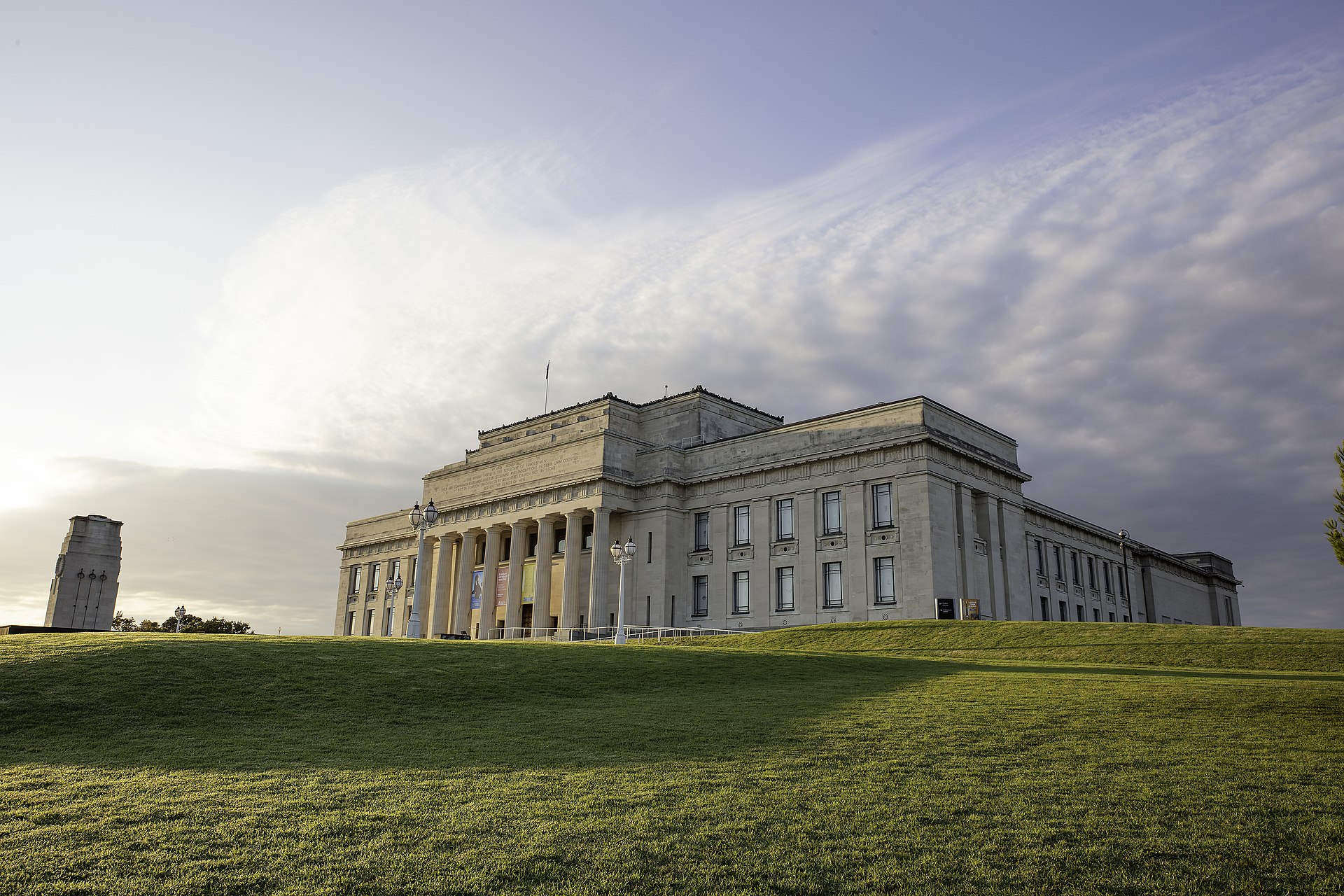
The Auckland War Memorial Museum (Tāmaki Paenga Hira) is the city's most important museum — a Greek Revival temple atop a volcanic cone in the Auckland Domain that combines three collections: New Zealand's finest Māori and Pacific taonga (treasures), a natural history collection, and a WWI and WWII memorial that is New Zealand's most visited. The building was completed in 1929 and extended with a copper-dome atrium in 2007. The Māori Court displays a fully carved meeting house (Hotunui, built 1878), a 25-metre war canoe (Te Toki-a-Tāpiri, the last great Māori war waka), and the Origins gallery covering 1,000 years of Polynesian navigation. The Pacific collection — the finest outside the islands themselves — includes Cook Islands ceremonial costume, Fijian war clubs, and the Tongan tapa cloth collections that anchor the museum's claim to being the keeper of Polynesian cultural memory. The 45-minute daily Māori cultural performance (haka, waiata, poi) in the Māori Court is one of the best in the city.
Auckland Zoo
Motions Road, Western Springs
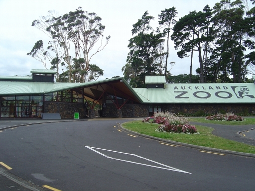
Auckland Zoo is New Zealand's largest zoological collection — 17 hectares in Western Springs holding about 135 species, with a focus on native New Zealand fauna (kiwi, tuatara, kea) and on immersive habitat design that has won international awards. The 2020 Strangely Beautiful precinct, dedicated to tuatara and native lizards, and the African savanna that holds giraffes, zebras, and rhinos in an open enclosure are the highlights. The Te Wao Nui section — the zoo's New Zealand native wildlife precinct — allows visitors to walk through a cloud forest aviary, a nocturnal kiwi house, and wetland areas where tuatara and other native reptiles can be observed in replicated natural settings. The zoo's close partnership with the Department of Conservation has supported breed-for-release programs for over 20 threatened native species. Adjacent is MOTAT (Museum of Transport and Technology) and Western Springs park, making a good combined half-day for families.
Britomart Precinct
Britomart, Auckland CBD
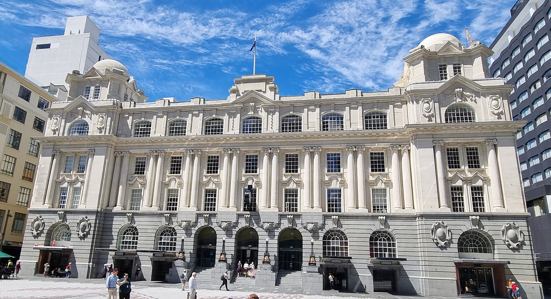
Britomart is Auckland's regenerated waterfront commercial district — a 2.5-hectare block of restored Edwardian warehouses (18 heritage buildings) and modern glass-and-steel infill around the Britomart Train Station that transformed from a decaying harbourside industrial zone into the city's most sophisticated commercial precinct during the 2003-2015 rebuild. The precinct houses the flagship stores of most of New Zealand's best design labels (Karen Walker, Kate Sylvester, Deadly Ponies) as well as the restaurants and cafés that anchor downtown commercial life. The Britomart Station (opened 2003 inside the restored 1912 Chief Post Office, Auckland's largest kauri-beamed public space) is the city's main commuter rail terminus, and the City Rail Link (due to open in 2026) will extend the line underground through the CBD — a project that has dominated downtown construction for a decade. Britomart's public spaces (Takutai Square, the Britomart Terminal forecourt) host seasonal events and the summer outdoor cinema.
Commercial Bay & Downtown Dining
Quay Street, Auckland CBD
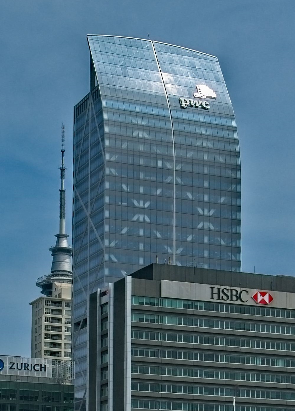
Commercial Bay is Auckland's newest downtown precinct — a 2020-opened retail-and-dining complex at the base of the PwC Tower on Quay Street, directly facing the waterfront, that concentrates high-end retail (Prada, Gucci, Jo Malone) with the Harbour Eats food hall (20+ operators including Cotto, Miann, Baduzzi) and the rooftop dining terraces with harbour views. The precinct connects directly to the Britomart Station below, making it the first stop for most cruise ship visitors. The adjacent Lower Queen Street pedestrianisation (completed 2020 as part of the downtown seawall rebuild) connects Commercial Bay to Queen Street via a much-improved urban plaza. The Ahi Restaurant on the ground floor specialises in modern New Zealand cuisine using indigenous ingredients (pūhā, kawakawa, horopito) and has been rated among Auckland's best fine-dining rooms since opening. The top-floor sky bars (Ada & Ray) provide bar seating with some of the best downtown views.
Cornwall Park
Greenlane Road West, Epsom
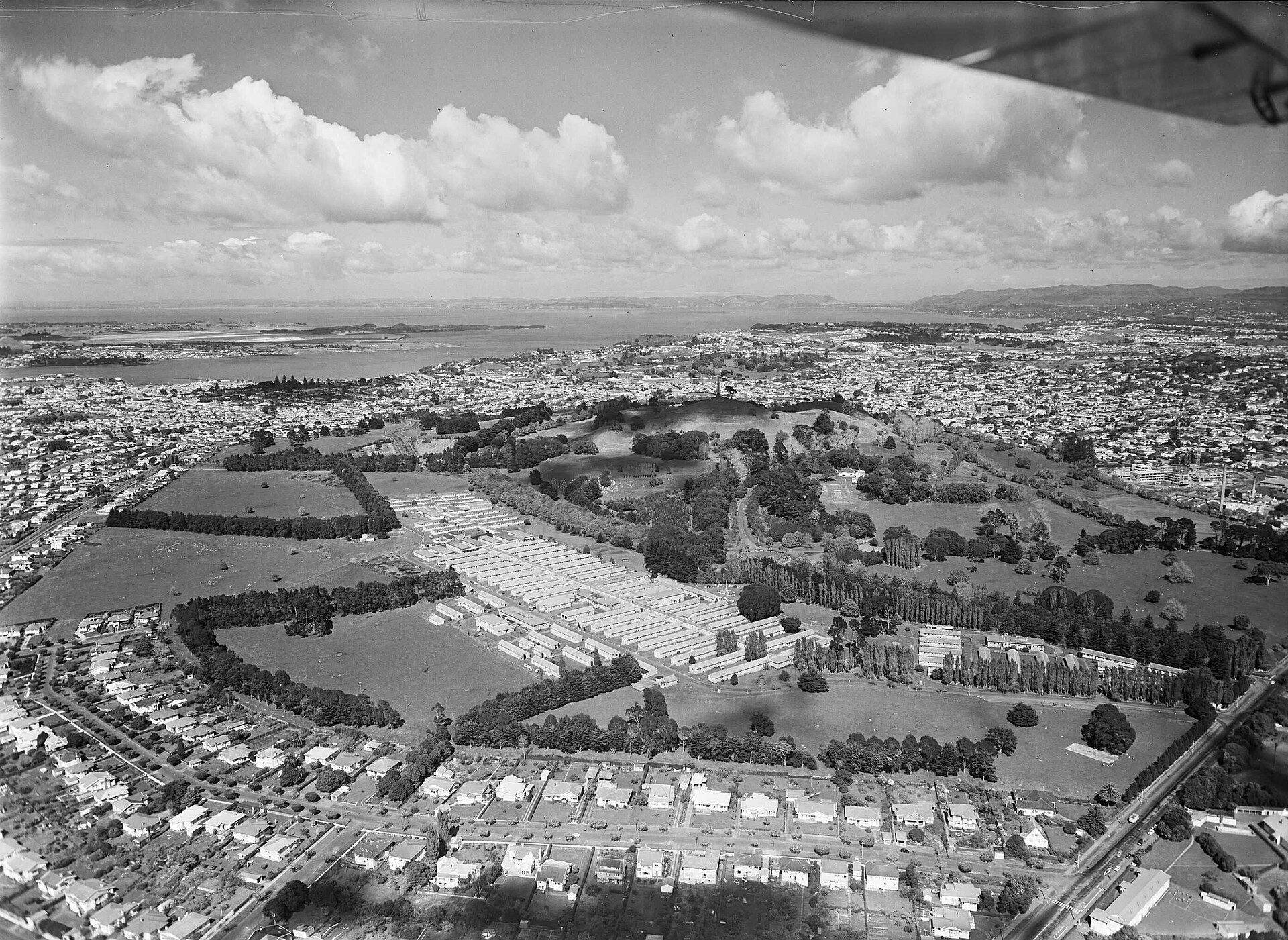
Cornwall Park is 220 hectares of working farmland in the middle of Auckland — gifted to the city in 1901 by John Logan Campbell as a 'people's park' and still grazed by sheep, beef cattle, and the Belgian blue breeding herd that makes the park a surreal pastoral landscape ringed by suburban houses. The park adjoins Maungakiekie / One Tree Hill, and the walk from the Huia Lodge gatehouse to the summit of the cone takes about 30 minutes through paddocks, grape vines, and ancient pōhutukawa trees. Acacia Cottage (1841, one of the oldest buildings in Auckland), the Sir John Logan Campbell Auctioneer's Clock Tower, and the Observatory at the southern end are the park's heritage buildings. Free parking, open 24 hours, and the café beside the Huia Lodge serves weekend breakfasts that have been an Epsom institution for decades. The park hosts the Classic Car Club's monthly Sunday meet and other community events.
Devonport (Ferry & Walk)
Devonport, North Shore
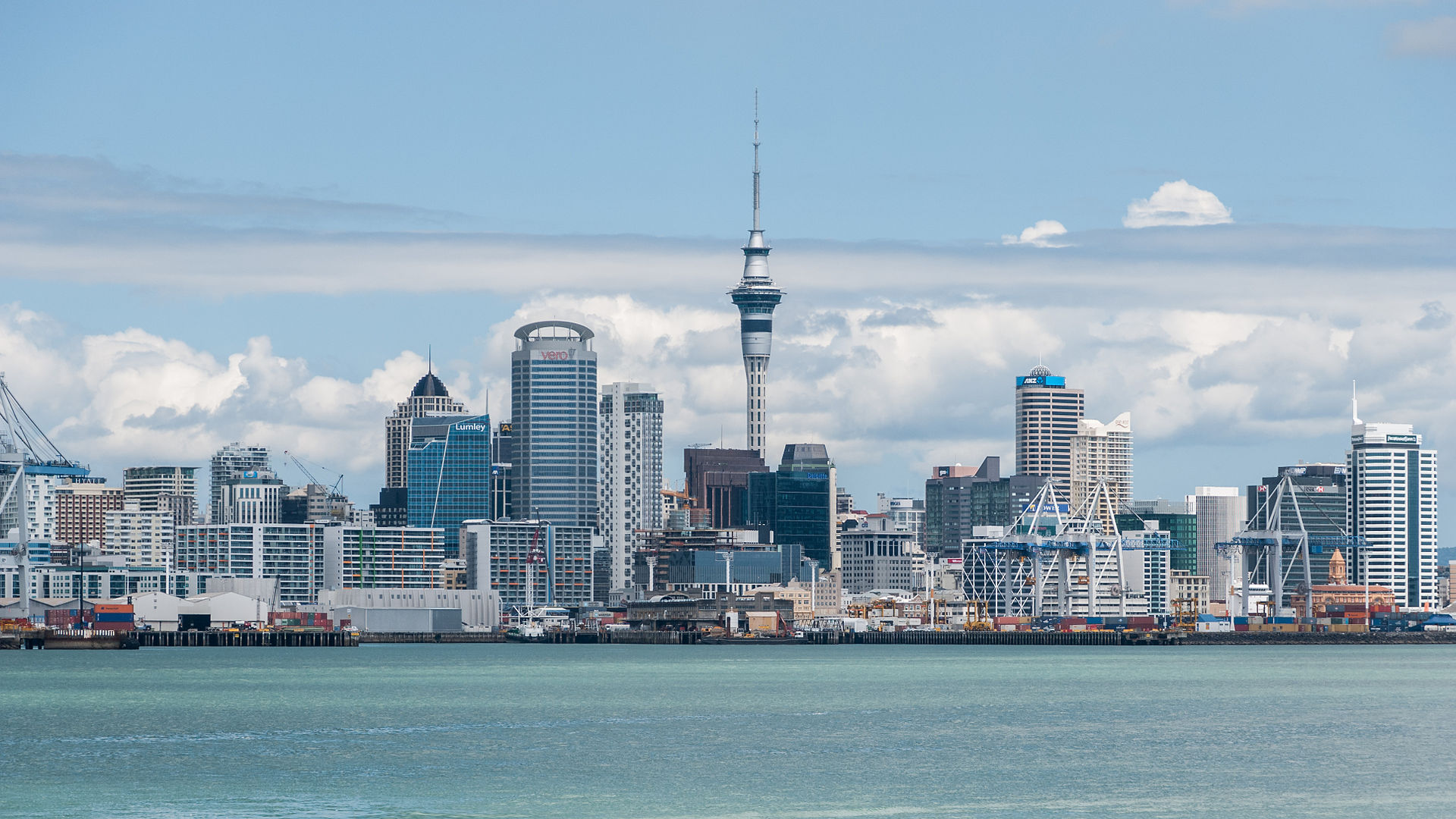
Devonport is a Victorian seaside suburb on the North Shore — a 12-minute ferry ride from the downtown Auckland ferry terminal that functions like a weekend time capsule, preserving the 19th-century wooden villas, corner shops, and military heritage of Auckland's oldest European settlement. The main street (Victoria Road) is lined with bookstores, cafés, and art galleries that make a 2-hour walking loop one of the best short excursions from the city. Mount Victoria (Takarunga) and North Head (Maungauika) — both small volcanic cones at the harbour edge — provide 360-degree views over the Waitematā Harbour and access to complex underground Victorian-era coastal fortifications (built in the 1880s in fear of Russian invasion, later used in both world wars). The tunnels on North Head can be explored for free with a torch. The Devonport Museum, the Naval Museum, and the annual Devonport Food & Wine Festival (February) anchor the community life.
Eden Park
Reimers Avenue, Kingsland
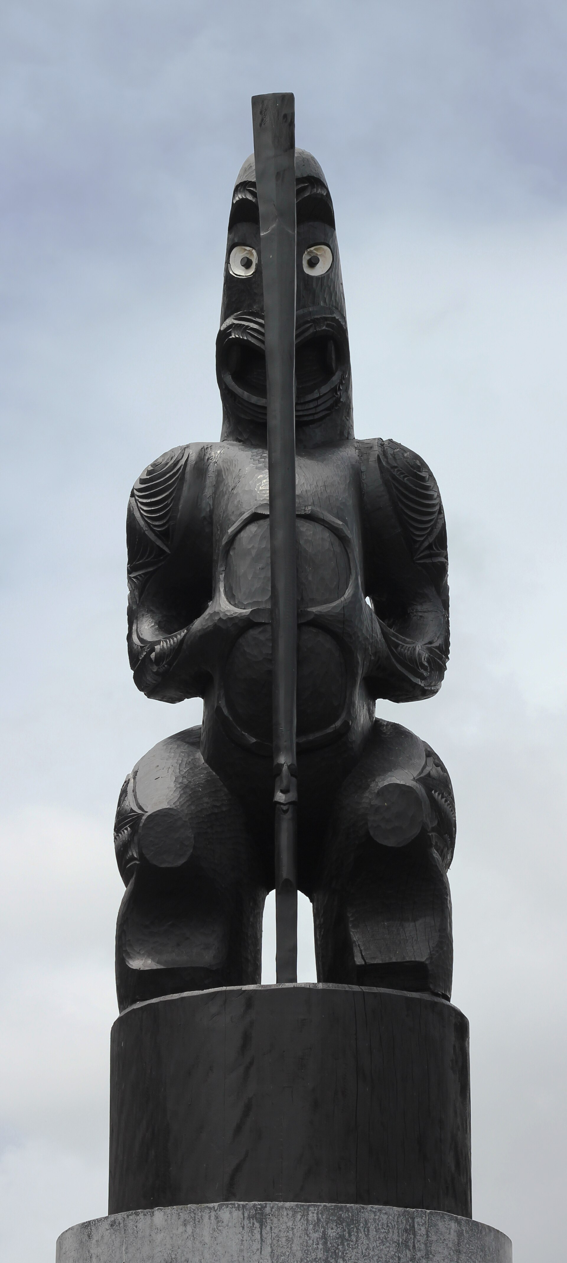
Eden Park is New Zealand's national stadium — a 50,000-capacity rugby and cricket ground in Kingsland that has been the primary venue for All Blacks Test matches since 1921 and for Black Caps cricket since 1930, and has hosted two Rugby World Cup finals (1987 and 2011) plus the 1992 Cricket World Cup final. The ground sits in a residential neighbourhood, a unique characteristic in world stadium architecture — matches are literally played in people's front yards. Behind-the-scenes stadium tours (90 minutes, most days except match days) include the changing rooms, the tunnel, and the field, and are the best way for rugby fans to experience a place where many of the game's greatest matches have been played. The adjacent Kingsland village has Auckland's densest concentration of rugby-watching bars and eateries — matches here fill the surrounding streets with tens of thousands of fans. Train access from downtown Auckland takes 12 minutes to Kingsland Station.
Karangahape Road (K Road)
Karangahape Road, Auckland CBD
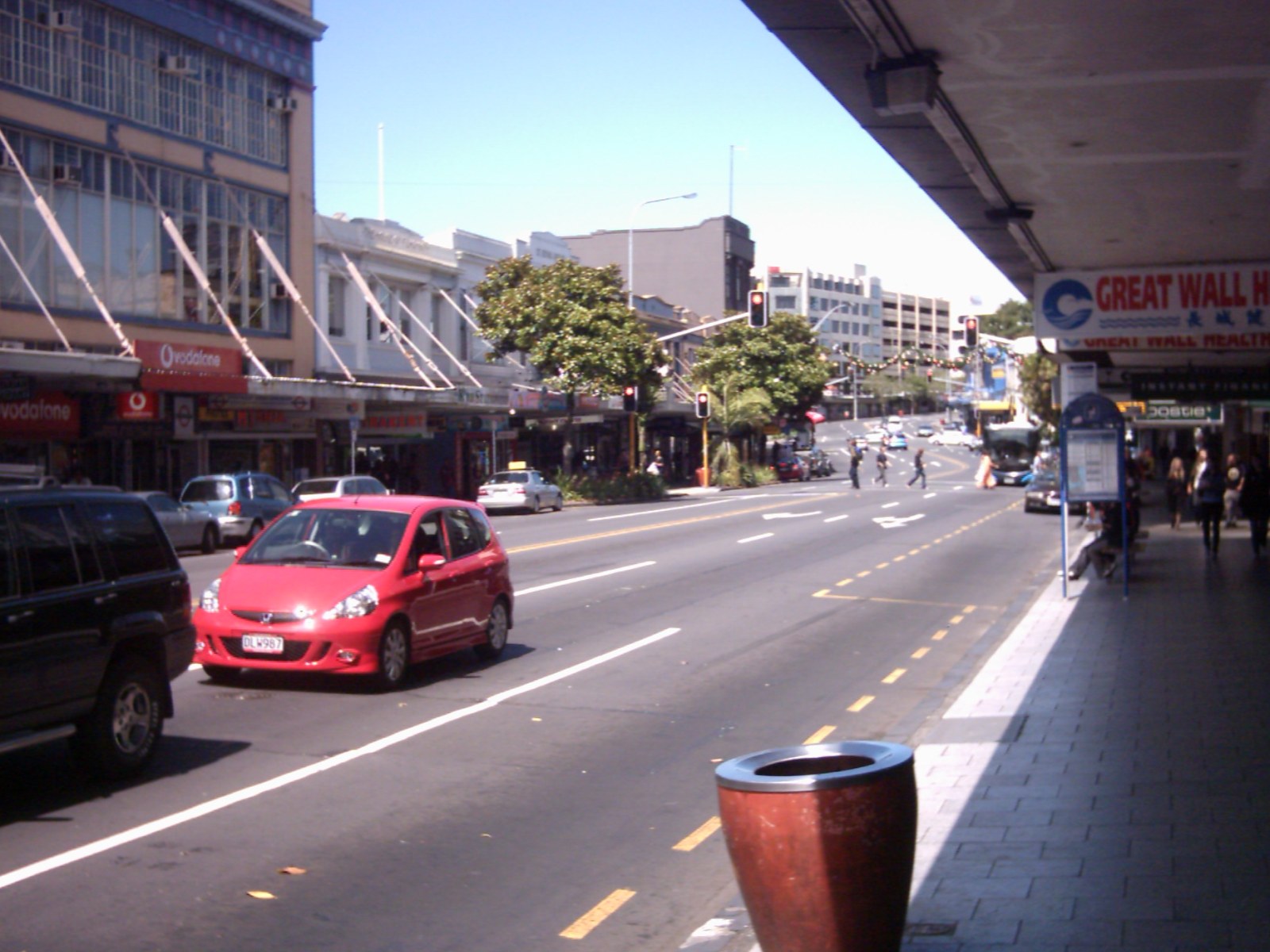
Karangahape Road — universally known as K Road — is Auckland's alternative high street, a mile-long strip along the southern edge of the CBD that was once the city's red-light and working-class Pacific neighbourhood and has since become the centre of Auckland's queer, arts, and alternative scenes. The Art Deco Naval & Family Hotel, the restored Edwardian St Kevin's Arcade, and the Pacific markets (Samoan-owned bakeries, Tongan fabric stores, Indian spice shops) preserve the layered social history. K Road is now Auckland's densest concentration of galleries (Artspace Aotearoa, Michael Lett, Coastal Signs), independent music venues (Whammy Bar, the Wine Cellar), drag bars, and restaurants. The Pink Pony Club brunch is Auckland's gay institution, and the K Road Market on Saturdays fills the street with food stalls, buskers, and crowds that reflect the city at its most diverse. The K-Road upgrades completed in 2024 added wider footpaths, public art, and a protected cycle lane.
Karekare Beach
Karekare, Waitakere Ranges
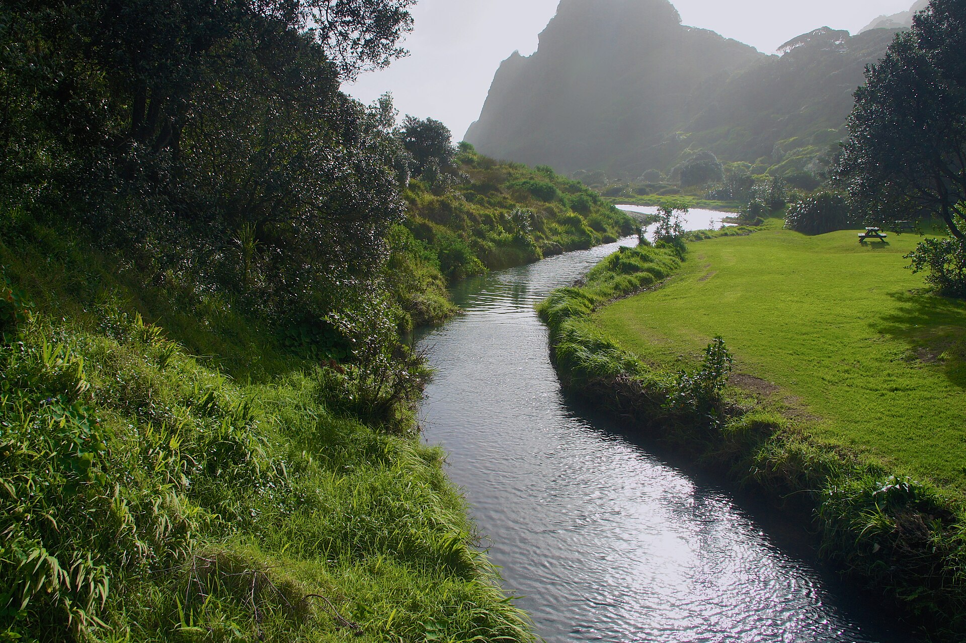
Karekare is Piha's wilder, less-developed neighbour — a black-sand beach 5 kilometres south of Piha in the Waitakere Ranges that was the filming location for Jane Campion's 1993 film 'The Piano' and has retained the raw, romantic atmosphere that drew Campion there. The beach is reached by a 10-minute walk from the car park through native bush and across a coastal stream, which keeps the crowds lighter than at Piha. The 30-metre Karekare Waterfall (Te Ahoaho), fed by one of the creeks draining off the ranges, is a 15-minute walk from the beach car park and is often almost deserted. The 4.5-kilometre round-trip coastal walk north to Piha via Mercer Bay includes vertiginous cliff-top sections with some of the best ocean views in the Auckland region. Like Piha, Karekare's swimming is dangerous and only safe when the surf club is patrolling — even then, wading beyond knee depth is not recommended for non-surfers.
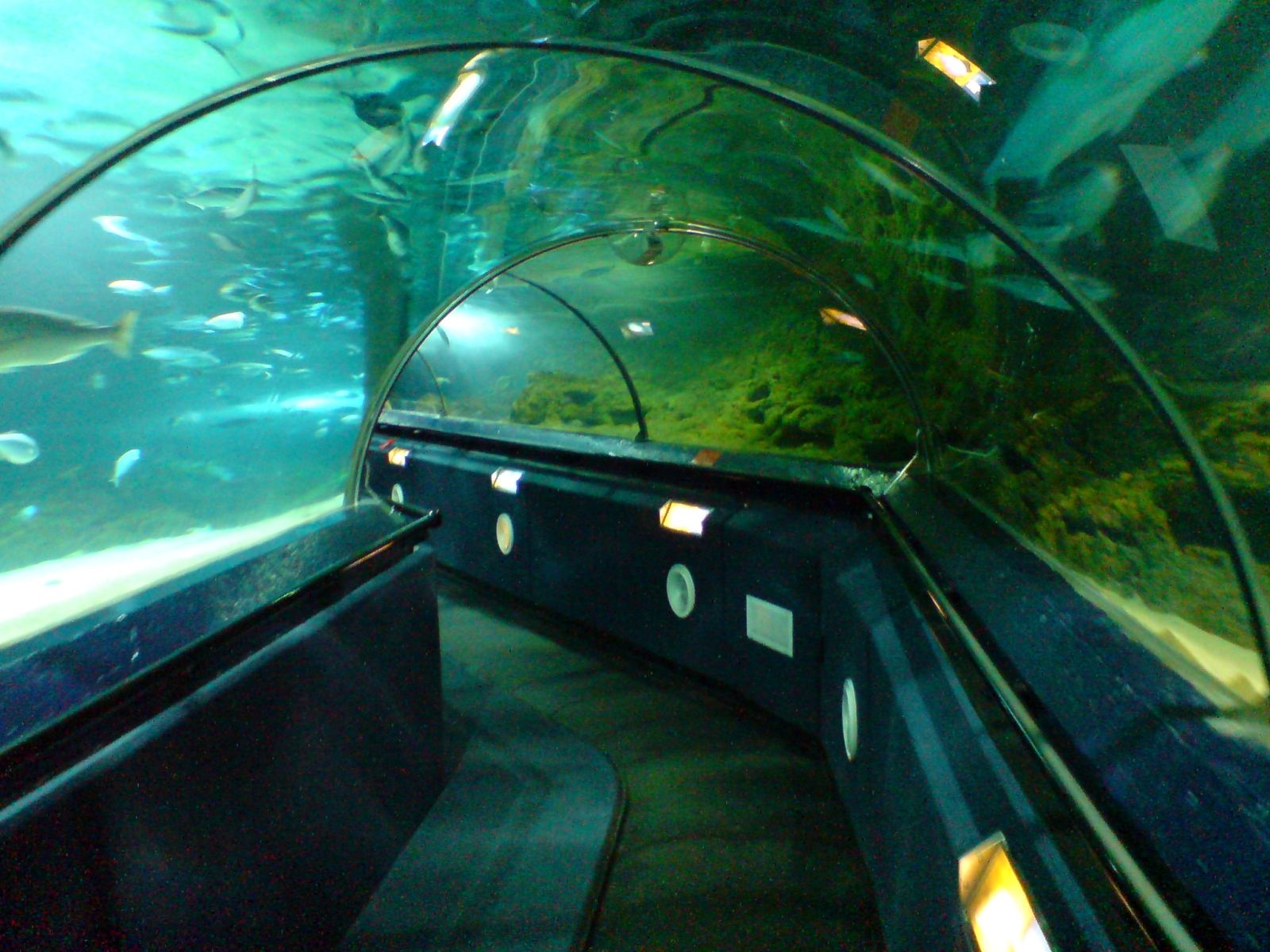
Kelly Tarlton's Sea Life Aquarium
23 Tamaki Drive, Orakei
Kelly Tarlton's SEA LIFE is Auckland's aquarium — built in 1985 by the late adventurer Kelly Tarlton inside disused underground sewage tanks on Tamaki Drive, becoming the world's first walk-through aquarium (using the then-new moving-walkway-through-acrylic-tunnel concept). Tarlton mortgaged his house to build it, opened it in April 1985, and died of a heart attack 6 weeks later at age 47. The facility now has Antarctic-themed enclosures (including the country's only king and gentoo penguins), a stingray touch pool, and the Shark Tunnel where visitors pass through a 110-metre acrylic tunnel surrounded by sharks and large fish. The sub-Antarctic experience is particularly strong — a reconstructed vintage Snowcat vehicle from a 1986 Antarctic expedition forms the gateway, and the temperature inside the penguin enclosure is kept at -2°C. The aquarium suits children more than adults but the under-10 charm is real.
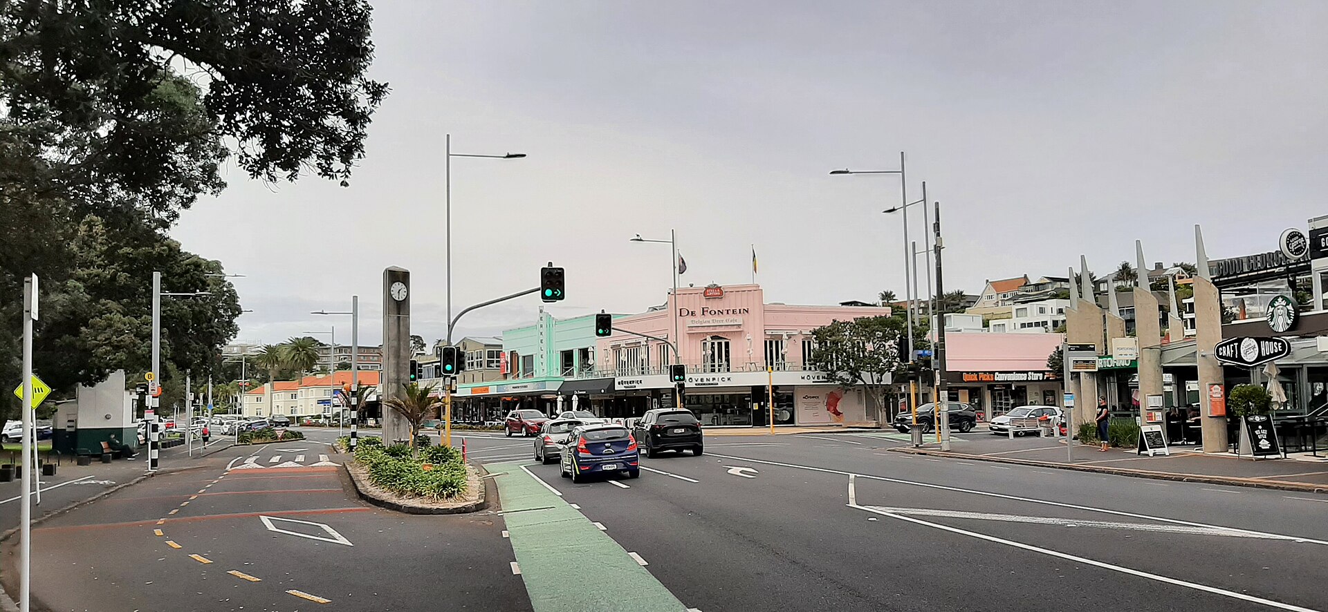
Mission Bay
Tamaki Drive, Mission Bay
Mission Bay is Auckland's city beach — a curved sandy bay along Tamaki Drive just 4 kilometres east of the CBD that functions as the city's favourite summer-evening hangout, with thousands gathering on the grass verge and the sand between November and March. The beach faces the Waitematā Harbour with Rangitoto Island rising behind the water, creating one of the city's defining panoramas. The cafés, gelato shops, and restaurants along the Mission Bay strip (Selera, Moo Chow Chow, and De Fontein Belgian Beer Café are anchors) absorb the summer crowds. The Melanesian Mission House at the eastern end of the beach is the oldest stone building in Auckland (built 1859 as a training college for Melanesian Christian converts) and is open occasionally for events. The bay is connected by a flat coastal walk/cycle path to St Heliers further east, and to the Viaduct further west, making it the heart of a 7-kilometre continuous waterfront.
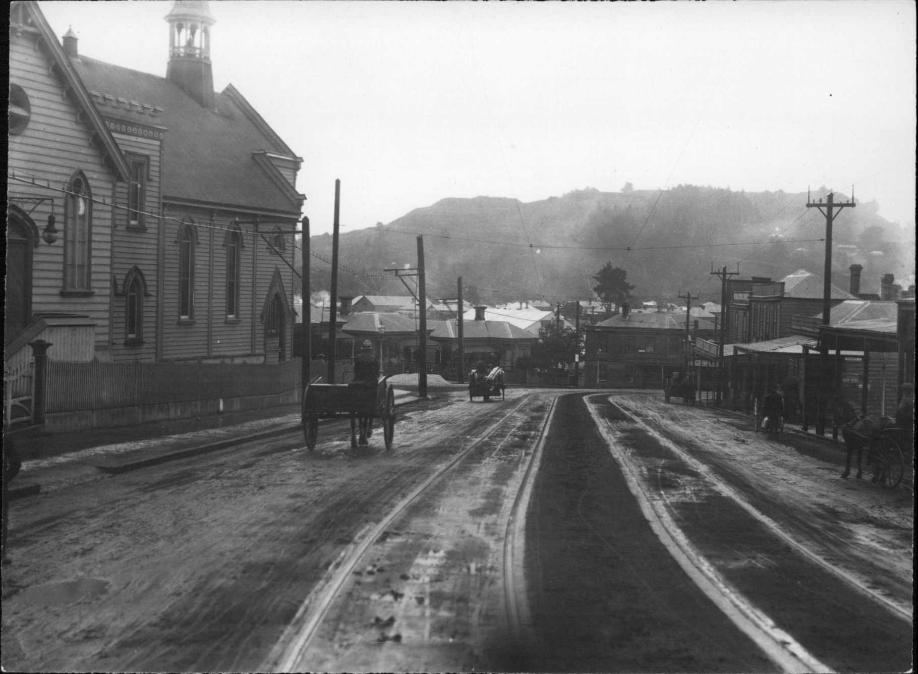
Mount Eden (Maungawhau)
Mt Eden Road, Mount Eden
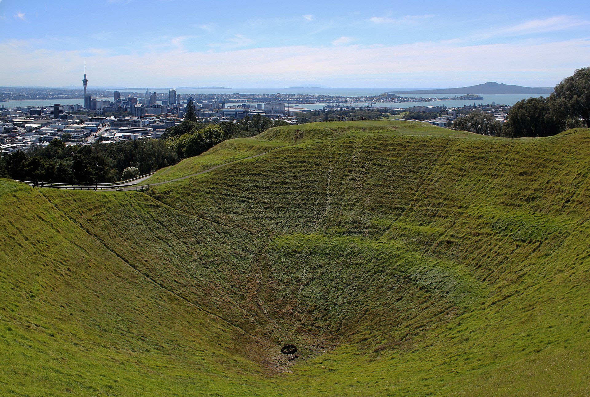
Maungawhau / Mount Eden is the highest natural point on the Auckland isthmus — a 196-metre volcanic cone that last erupted about 28,000 years ago and was one of the most important Māori pā (fortified settlements) in the country, with terraces, food storage pits, and defensive trenches carved into the cone that are still visible today. The summit provides a complete 360-degree view of Auckland, both harbours, and on clear days Rangitoto Island, the Sky Tower, and the distant Waitakere Ranges. The 50-metre-deep crater at the summit (Te Ipu-a-Mataaho, 'The Bowl of Mataaho') is a sacred site — visitors are asked not to enter it, and the grass inside is left uncut as a sign of respect. The short walk to the summit takes 15-20 minutes from the main car park, or 30-40 minutes from the village of Mount Eden (with its boutique shops and cafés) below. The cone is one of 53 volcanoes that make up the Auckland Volcanic Field, which is still considered active.
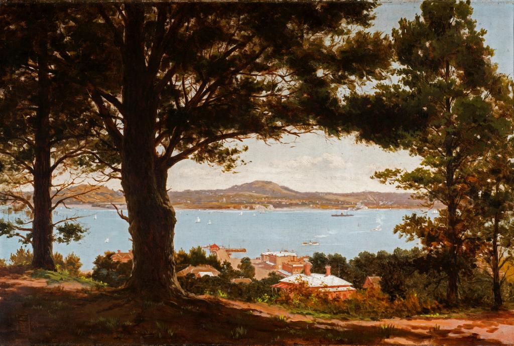
Mount Victoria (Takarunga)
Kerr Street, Devonport
Mount Victoria (Takarunga) is a small volcanic cone behind Devonport village on the North Shore — only 87 metres tall but offering one of the best panoramic views of Auckland, with the downtown CBD, the Harbour Bridge, the Waitematā, and the outer islands all visible from the summit. The cone was a pre-European Māori pā, and the terracing visible on the upper slopes marks the original fortifications. The summit is reached by a 10-minute walk from Kerr Street car park, or by driving directly to the top via a narrow single-lane road. The red-roofed signal station at the summit is a preserved 19th-century semaphore post that used to signal the arrival of ships to downtown Auckland before the advent of the telegraph. Takarunga is paired with North Head (Maungauika) — a second small cone at the tip of Devonport — to provide a complete North Shore viewing circuit in about 90 minutes.
Muriwai Gannet Colony
Muriwai Beach, Rodney
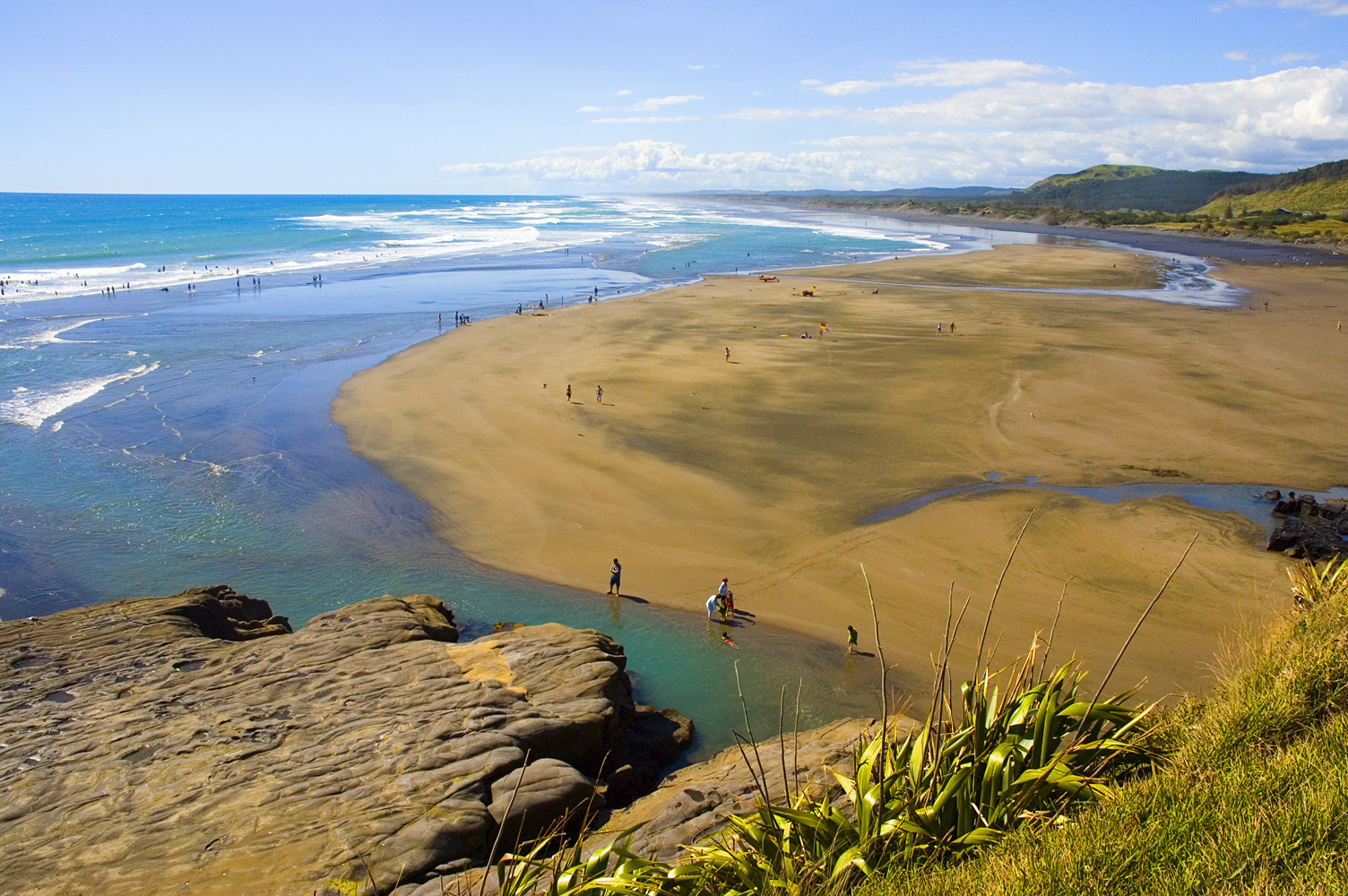
Muriwai is the home of Auckland's mainland gannet colony — over 1,200 pairs of Australasian gannets that nest on a rocky headland (Ōtakamiro Point) between Muriwai Beach and Maukatia (Māori Bay), packed so densely that the rocks appear white from a distance. The colony is one of only three mainland gannet colonies in the world (the others at Cape Kidnappers and Farewell Spit), and viewing platforms get within 2 metres of the birds, allowing extraordinary close-up observation of courtship, nest-building, and fledging. The birds arrive in August and leave for Australia in February, with peak viewing November-January when the chicks are growing. The adjacent Muriwai Beach is a 60-kilometre black-sand beach — one of the longest drivable beaches in New Zealand, with 4WD access along much of its length. Muriwai is also a famous hang-gliding and paragliding site, with launches off the same cliffs above the gannet colony. The 40-minute drive from Auckland passes through the wine country of Kumeu.

One Tree Hill (Maungakiekie)
Cornwall Park, Epsom
Maungakiekie / One Tree Hill is a 182-metre volcanic cone in the heart of Auckland — the largest pre-European pā (fortified Māori settlement) in the country, whose hillside terraces and food pits once supported thousands of people and whose summit was one of the most important ceremonial sites in the Auckland region. The 30-metre obelisk on top was erected in 1940 to honour Māori-Pākehā reconciliation, funded by the Scottish-born philanthropist John Logan Campbell (who lived at the base of the hill). The hill is named for a rātā tree that once stood at the summit — the 1852 replacement Monterey pine was attacked twice (1994 and 2000) by Māori activists angered by the substitution of a non-native tree, and was eventually removed in 2000. After two decades of debate and consultation with local iwi, six native trees were planted on the summit in 2016. Cornwall Park surrounds the hill with paddocks of grazing sheep, cattle, and Belgian blue beef steers, preserving a pastoral landscape unique in a city of 1.7 million.
Parnell Village
Parnell Road, Parnell
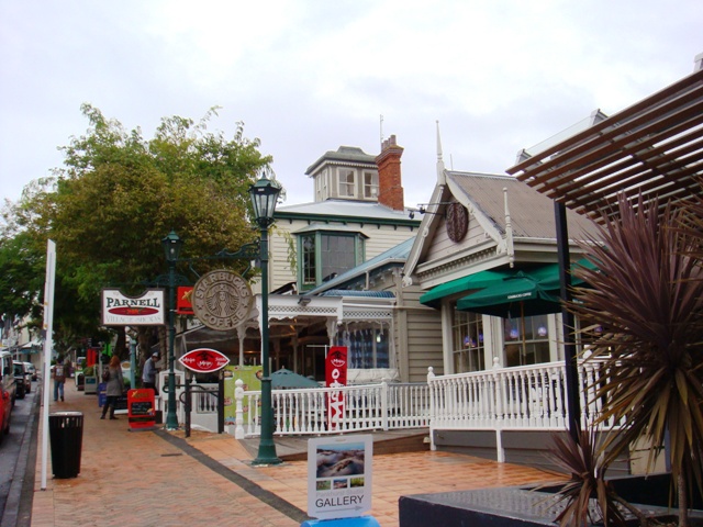
Parnell is Auckland's oldest surviving suburb — a ridge-top residential and commercial district of restored Victorian and Edwardian wooden villas, converted wool stores, and boutique retail immediately east of the CBD. Parnell Village, the central shopping strip along Parnell Road, was created in the 1970s by developer Les Harvey as New Zealand's first pedestrian-oriented boutique district and influenced the later transformation of similar neighbourhoods in the country. The Parnell Rose Gardens (at the northern end of Parnell), the early Neo-Gothic Holy Trinity Cathedral (still unfinished after 130 years of construction), and Ewelme Cottage (an 1864 pioneer cottage on Ayr Street, Auckland's oldest remaining kauri cottage) together form a heritage walk. Parnell has many good restaurants (Non Solo Pizza is an Italian institution since 1998, and Domain & Ayr is the neighbourhood's modern brunch leader), and the proximity to both the War Memorial Museum and the Domain makes it a natural afternoon add-on.
Piha Beach
Piha, Waitakere Ranges
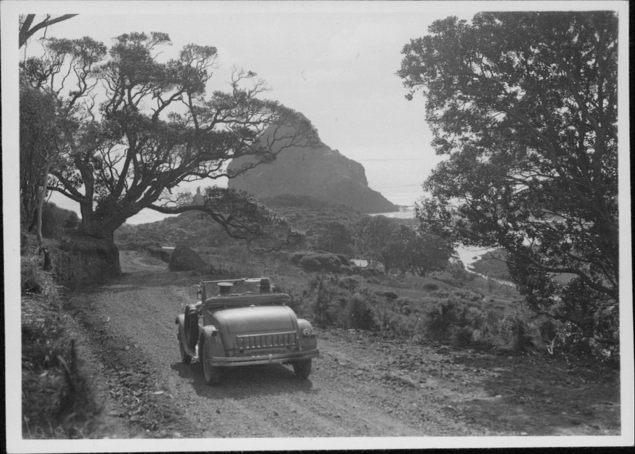
Piha is Auckland's most iconic west coast beach — a 3-kilometre stretch of black iron-sand, towering cliffs, and the free-standing volcanic Lion Rock (Te Piha) in the middle, 40 kilometres west of the city through the rainforest-covered Waitakere Ranges. The black sand (from the erosion of nearby volcanic headlands) can reach 60°C on hot days, so walking barefoot requires caution. Piha's powerful swells make it one of New Zealand's most famous surf beaches, but also one of the most dangerous — the rip currents claim lives regularly and swimming is only safe between the flags at the Piha Surf Life Saving Club patrol. The TV show 'Piha Rescue' documented the lifeguards' work over 15 seasons. The 101-metre Lion Rock can be climbed partway (the upper section was permanently closed in 2011 due to landslip risk) for superb cliff-top views. Piha and its twin beach Karekare are both reached by winding road through the Waitakeres — the 90-minute drive from central Auckland through giant kauri forest is part of the experience.
Ponsonby
Ponsonby Road, Auckland
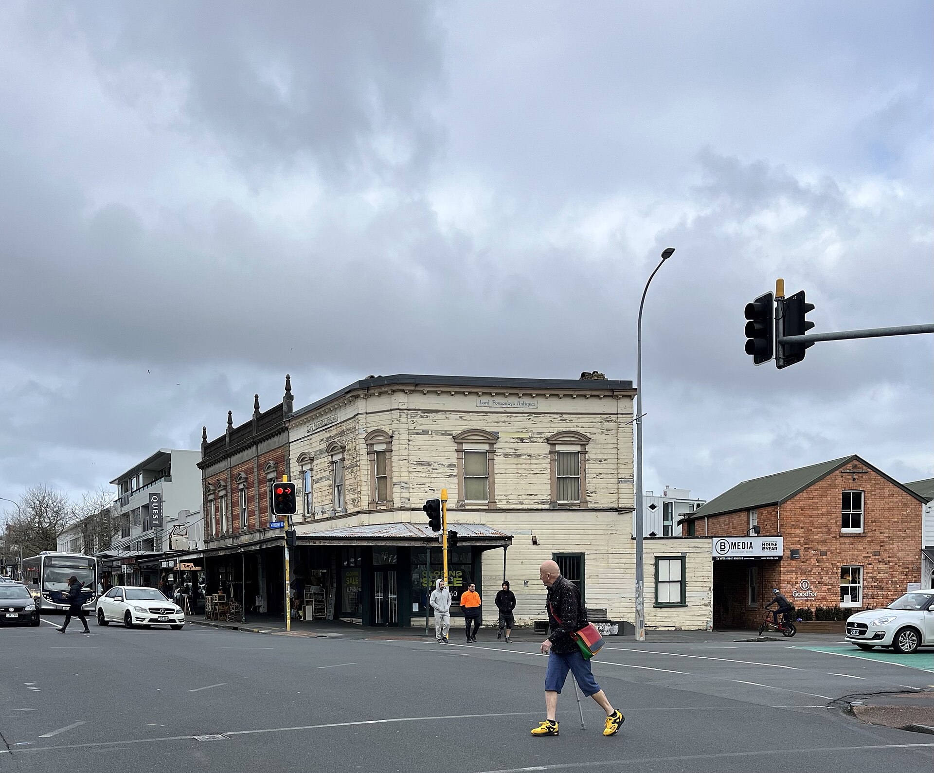
Ponsonby is Auckland's most fashionable suburb — a ridge-top neighbourhood of restored Victorian villas west of the CBD whose main street (Ponsonby Road) has transformed from a working-class Pasifika community in the 1970s to the city's densest concentration of good restaurants, design stores, and boutique retail. The gentrification is now complete and somewhat contested, but the food scene is genuinely world-class. Anchor restaurants include SPQR (a 30-year Italian institution), Prego (Auckland's best pizza since 1986), Ponsonby Central (a food hall with a dozen operators), and the casual cafés that anchor neighbourhood life at brunch. The parallel streets (Franklin Road in particular) are lined with well-preserved Victorian villas — Franklin Road is famous for its Christmas light displays that draw crowds throughout December. The Ponsonby Markets on Saturday mornings (Italian deli, French bakery, street food) are a good way to sample the neighbourhood's food culture.
Rangitoto Island (Day Trip)
Rangitoto Island, Hauraki Gulf
Rangitoto is Auckland's youngest and most iconic volcano — a 260-metre shield cone that erupted 600 years ago from the floor of the Hauraki Gulf, making it the most recent volcanic eruption in the Auckland field and geologically unique among the 53 local volcanoes. The island is 25 minutes from downtown Auckland by Fullers Ferry, and its symmetrical silhouette is the defining view from every Auckland waterfront. The summit walk takes about an hour each way through lava fields where the world's largest pōhutukawa forest has grown directly out of bare rock, and includes the fascinating lava caves (discovered in the 1950s) that formed when lava tubes drained. The summit provides one of the best views of Auckland city. The island is now a pest-free sanctuary — no rats, possums, or stoats — and is home to nesting bellbirds, tui, and the occasional kākā (bush parrot). The last inhabitants (in the 30 historic baches, or beach huts) left in the 1970s, but a few baches have been preserved as a heritage walk.
Sky Tower
Victoria Street West, Auckland CBD
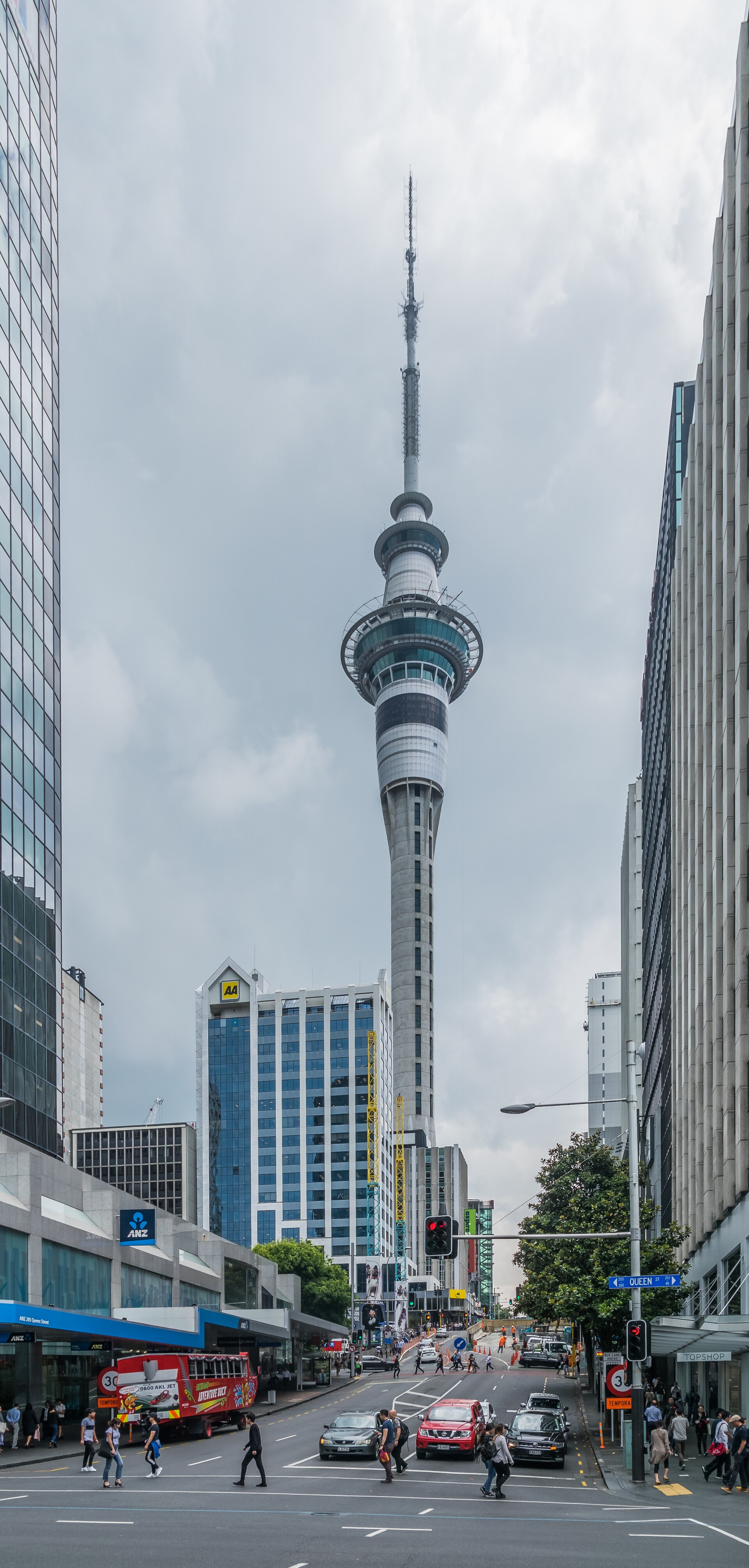
The Sky Tower is Auckland's defining landmark — at 328 metres it is the tallest free-standing structure in the Southern Hemisphere and has dominated the city skyline since 1997. The tower combines observation decks (at 186m and 220m, with glass floor panels that provide vertigo-inducing views straight down to Federal Street), a revolving restaurant (Orbit 360°, one complete rotation per hour), and the SkyJump, a 192-metre wire-controlled jump from the main deck that reaches speeds of 85 km/h. The tower was built to be the centrepiece of the SkyCity casino complex, and the blend of casino, hotel, restaurants, and observation platform creates a vertical city inside a single structure. The tower is lit in different colours nightly to mark holidays, sports victories, and charity campaigns, making it Auckland's largest canvas. On clear days the view extends 80 kilometres — the Coromandel Peninsula visible to the east, the Waitakere Ranges to the west.
Tāmaki Drive Waterfront Walk
Tamaki Drive, Auckland
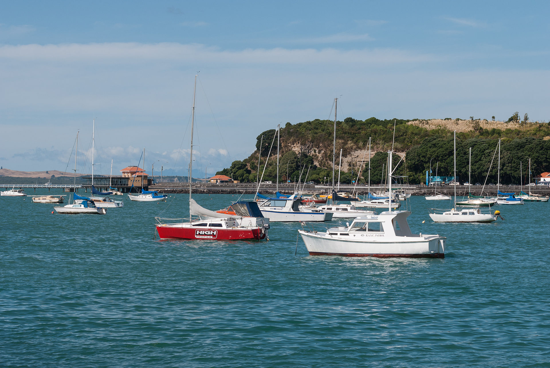
Tāmaki Drive is the coastal road that connects the Auckland CBD to the eastern bays — an 8-kilometre waterfront boulevard built in the 1920s as a public-works project that now provides a flat walking, running, and cycling path with unbroken views across the Waitematā Harbour to Devonport, Rangitoto, and (on clear days) the Coromandel Peninsula. The walk passes Ōkahu Bay (the site of the Ngāti Whātua village forcibly cleared in the 1950s and now restored as a heritage precinct), Mission Bay, Kohimarama, and St Heliers before ending at the Achilles Point viewpoint. The drive is Auckland's premier weekend exercise corridor — thousands run and cycle along it daily — and the grass verges between the road and the beach are lined with families picnicking in summer. The Bastion Point monument and Ōkahu Bay Marae, representing the Ngāti Whātua o Ōrākei iwi, anchor the Māori history of the area. The drive can be walked in sections or ridden end-to-end in about an hour.
Viaduct Harbour
Viaduct Harbour, Auckland CBD
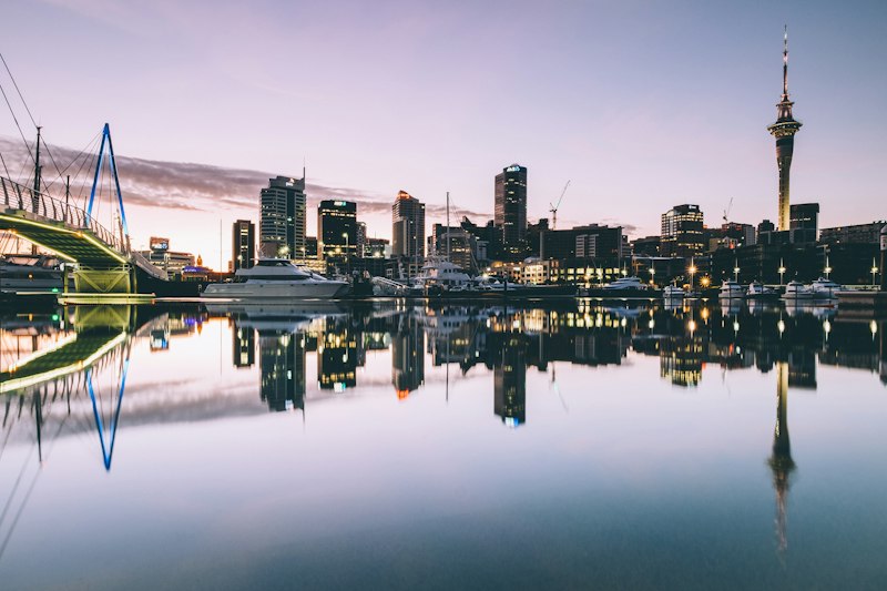
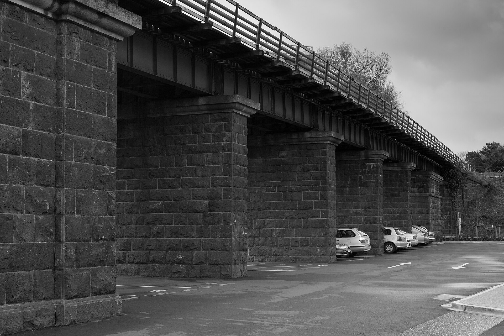
Viaduct Harbour is Auckland's waterfront precinct — a former fishing port transformed for the 2000 America's Cup defence into a ring of restaurants, bars, and superyacht berths around an inner harbour basin. The precinct is the city's premier dining destination, especially on warm evenings when the tables outside Soul Bar, Euro, and Cibo fill with Aucklanders and the boats' mast lights reflect in the water. The America's Cup legacy is everywhere — Team New Zealand's base is still at the head of the harbour, the AC40 and AC75 foiling yachts are often moored for maintenance, and the National Maritime Museum on the western edge (with a collection of historical vessels including the pre-WWI scow Ted Ashby, which still operates weekend sailing trips) preserves the wider maritime context. Wynyard Quarter immediately west extends the waterfront walk with more open spaces, the Silo Park playground (in a converted cement silo), and the Auckland Fish Market.
Waiheke Island (Day Trip)
Waiheke Island, Hauraki Gulf
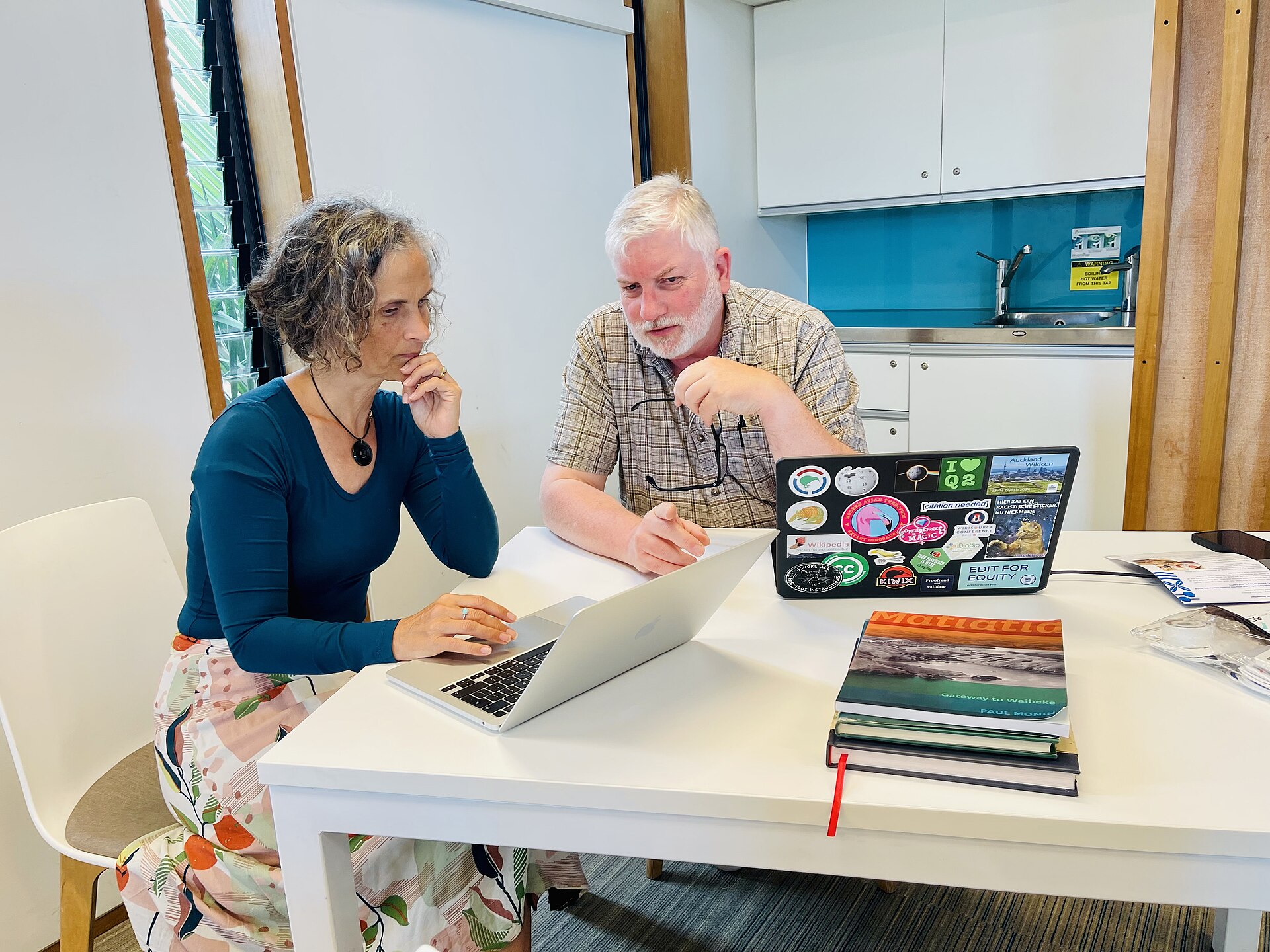
Waiheke Island is Auckland's weekend playground — a 92-square-kilometre island in the Hauraki Gulf 40 minutes from the city by ferry that has become New Zealand's most famous wine region in the last 30 years, with over 30 boutique wineries specialising in Bordeaux-style reds and Syrah that thrive in the island's warm microclimate. The signature experience is a wine tour (Mudbrick, Te Motu, Cable Bay, Stonyridge) with lunch at one of the vineyard restaurants, combined with a swim at Oneroa or Palm Beach. The island also has genuinely great beaches (Onetangi is a 3-kilometre sweep of white sand), some of the best art studios in the country, and the 4-hour Te Ara Hura coastal walkway that links vineyards, beaches, and clifftop viewpoints. Accommodation ranges from glamping to lodges, and many visitors stay a night or two rather than returning to Auckland the same day. The ferry service runs every 30 minutes during peak times.
Wynyard Quarter
Jellicoe Street, Auckland CBD
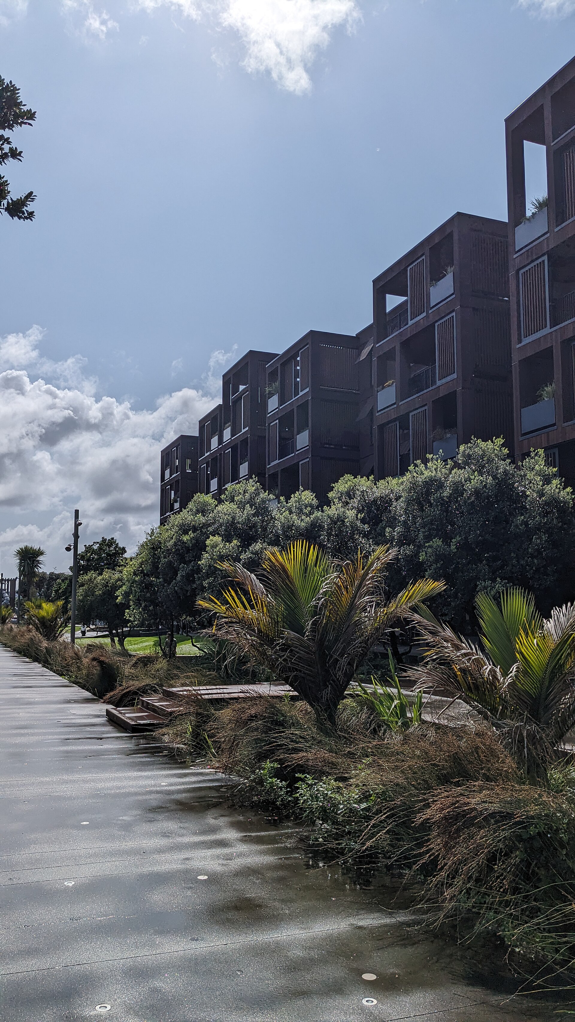
Wynyard Quarter is Auckland's newest waterfront precinct — a former industrial tank farm and port area immediately west of the Viaduct that was comprehensively redeveloped for the 2011 Rugby World Cup into a mixed-use quarter with restaurants, offices, public spaces, and the innovative Silo Park playground built in and around the old industrial cement silos. The quarter has continued to grow, and the 2021 America's Cup defence produced new public spaces including Te Wānanga (a waterfront plaza that extends into the harbour). The anchor attractions include the Auckland Fish Market, the Wynyard Crossing lifting bridge (Auckland's best harbour-selfie backdrop), the indoor-outdoor Wynyard Pavilion events space, and the North Wharf restaurant strip. The summer Silo Cinema, the winter light festival, and the weekend farmers' markets give the precinct a year-round rhythm that complements the adjacent Viaduct. The Wynyard Tram (a heritage-style tram that runs a 1.3-kilometre loop) is a charming way to move between the Viaduct and Silo Park.