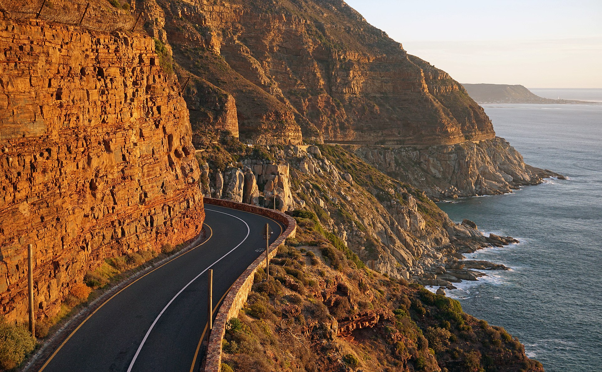
Chapman's Peak Drive is one of the most spectacular coastal roads in the world — a 9-kilometre toll road carved into the cliff face between Hout Bay and Noordhoek that hugs the contours of Chapman's Peak 600 metres above the Atlantic Ocean. The road, built by convict labour between 1915 and 1922, follows the geological boundary between granite below and sandstone above, which provides the natural shelf that the engineers exploited to carve the road into the mountainside.
The 114 curves, the sheer drops, and the views — looking south to the Sentinel above Hout Bay, north to Noordhoek's Long Beach stretching in a white arc below, and west across the open Atlantic where the next land is South America — make the drive an experience that operates somewhere between scenic road trip and controlled vertigo. Several viewpoints along the route provide stopping places for photographs, and the contrast between the road's engineering (carved from solid rock, with occasional sections of overhanging cliff above) and the natural landscape (mountain, ocean, fynbos, kelp) is extraordinary.
The road is part of the M6, connecting the Atlantic seaboard to the southern peninsula, and is the standard route for the Cape Point day trip. Cyclists ride the road in early morning before traffic builds, and the annual Cape Town Cycle Tour (the world's largest individually timed cycling event) uses Chapman's Peak as its most celebrated segment. The road is occasionally closed due to rockfalls, which is a reminder that the cliff is still actively eroding and that the road exists because human stubbornness temporarily prevailed over geology.
Verified Facts
Chapman's Peak Drive is approximately 9 kilometres long
The road was built between 1915 and 1922 using convict labour
The road has 114 curves
The Cape Town Cycle Tour is the world's largest individually timed cycling event
Get walking directions
Chapman's Peak Drive, Noordhoek, South Africa